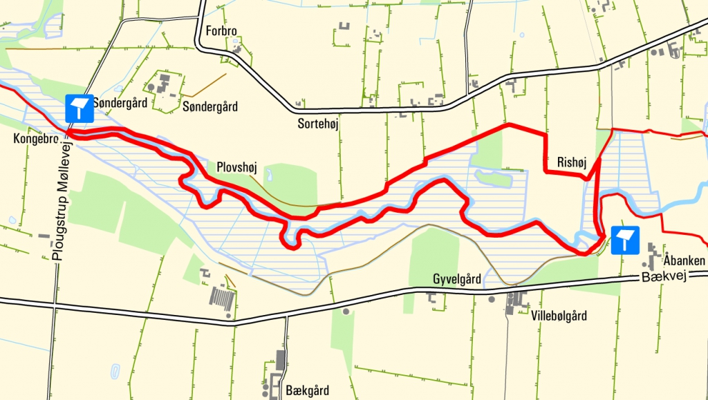
Round trip east of Plougstrup
5.5 kilometres

Please be aware that on this part of the route south of the river, it can often be very wet and hiking boots/wellington boots are a necessity - even in the summer months. On the other hand, you cannot get closer to the beautiful nature that is in the valley area of Kongeådal. Stick to the path, as the ground might be very soft and soggy on this stretch.
Dogs are not permitted on this route.
The trip starts at Plougstrup Møllevej where you can park your car along the dirt track.
You can start by walking on the north side of the river towards the east. Before long, you will reach a little forest, where you can enjoy the most stunning view of the river valley. Continue by following the designated marked posts. When you get to the self-closing footpath gate, where you can see a bridge over the stream towards the south, you should walk towards the bridge. After the bridge, you should head west and here you will come across a sign describing an ancient meadow irrigation system. As you are walking along the edge of one of the channels, you will be able to see for yourself the huge amount of work that was carried out.
By means of dams, sluices and dug-out channels, the water could be led several kilometres away from the river and into the fields. It gave nutrition to the crops and supplied drinking water for the animals.
On the way back to Plougstrup Møllevej you will go through many self-closing footpath gates and you will walk along many planks.

